

Gyro bias instability 10°/h (Allan Variance)
Accelerometer deviation 1.7mg (less than 4g range)

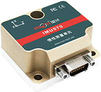
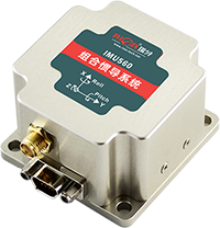
 Product Description
 Scope of application
 Parameter
 Dimensions
 Download
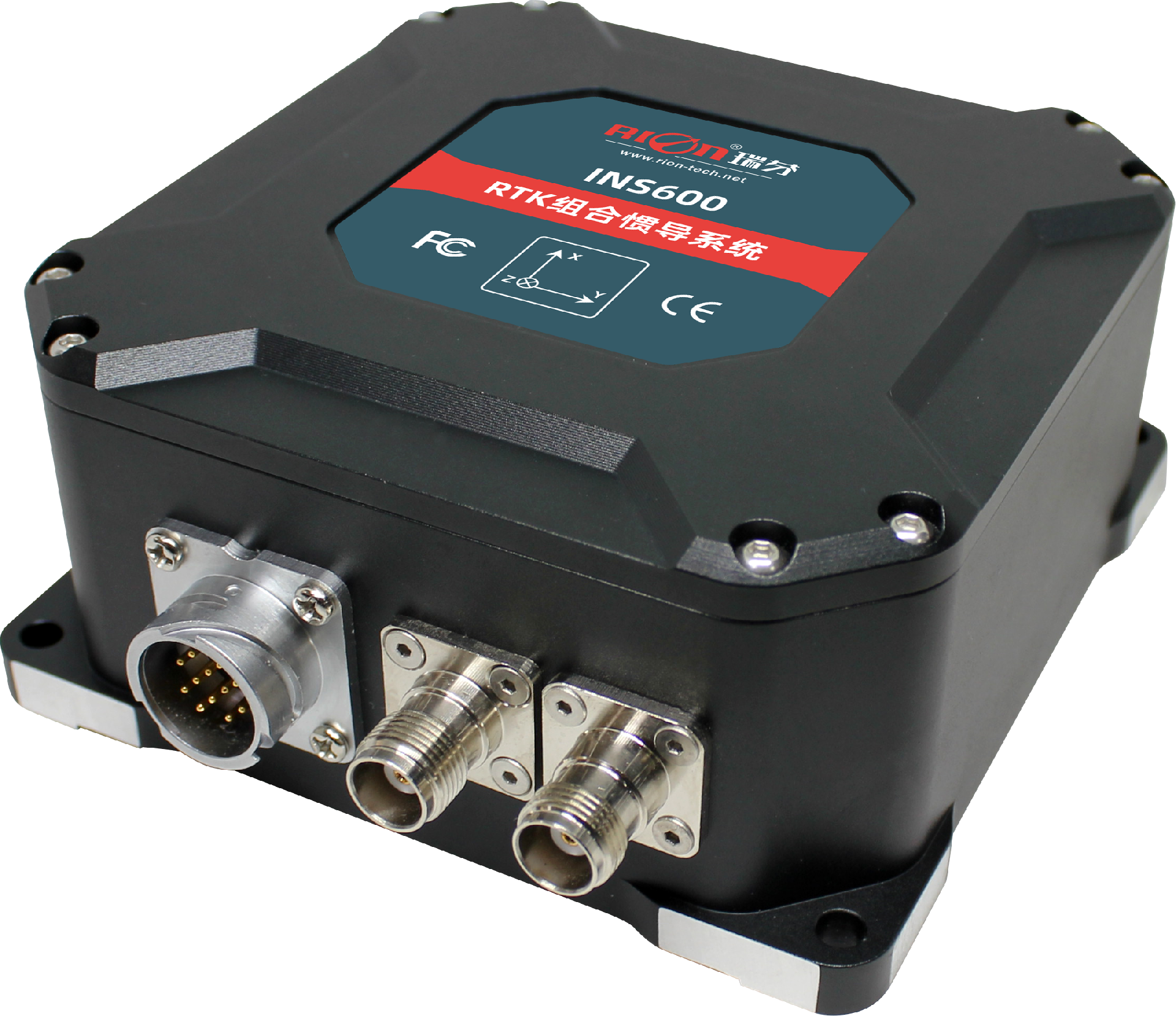
The INS600 series is a dual-antenna GPS/INS integrated navigation system built by RION. The dual-antenna differential positioning measurement unit (IMU) is precisely calibrated in the full temperature to meet the performance requirements in different environments. The multi-data Kalman filter fusion algorithm is realized by a built-in navigation computer, and outputs real-time accurate carrier posture, heading information, three-dimensional position and velocity information, and various inertial device information. The appearance is exquisite, the structure is small, the installation is convenient, the use is flexible, and the operation is more stable and reliable.


| INS600 |
|
| |
| System | Roll/pitch(1σ) | 0.2° | |
| GPS loss-lock accuracy (vehicle-mounted CEP) | Position drift(1km or 3min) | 0.2%,with odometer | |
| Heading drift (1min) | 0.15° | ||
| Gyro | Measuring range | 300°/s | |
| Zero bias instability (Allen variance) | 10°/h | ||
| Zero bias stability (1s smooth) | 15°/h | ||
| Zero bias repeatability | 15°/h | ||
| Full temperature zero bias | 0.1°/s | ||
| Scale factor nonlinearity | 200ppm | ||
| Scale factor repeatability | 200ppm | ||
| Resolution | <0.01°/s | ||
| Acceleration sensitivity | <0.0028°/s/g,rms all direction | ||
| Angle random walk | 0.15°/√hr | ||
| Bandwidth | 200Hz | ||
| Delay | <2ms | ||
| Accelerometer | Range | 4g | |
| Zero bias stability | 0.2mg | ||
| Full temperature zero bias | 1.7mg | ||
| Scale factor repeatability | 200ppm | ||
| Resolution | 0.1mg | ||
| Nonlinearity | 0.1% | ||
| Bandwidth | 200Hz | ||
| SatelliteNavigationBoard | Position(CEP) | 1.2m,2cm+1ppm(RTK) | |
| Speed(1s) | 0.03 m/s | ||
| Heading(1s) | 0.08°(base line 2m) | ||
| Frequency band | GPS L1,L2,L2C,Beidou B1,B2 | ||
| Interface | Input voltage | 12V | |
| Working current | 0.55A | ||
| Interface Type | 10 core aviation plug | ||
| Main engine | Size | 155*120*55mm | |
| Weight | 708g | ||
| Antenna | Size | 152*152*62.2mm | |
| Weight(single) | 433.5g | ||
| Data line | Size(length) | 5M | |
| Weight(single piece) | 30g | ||
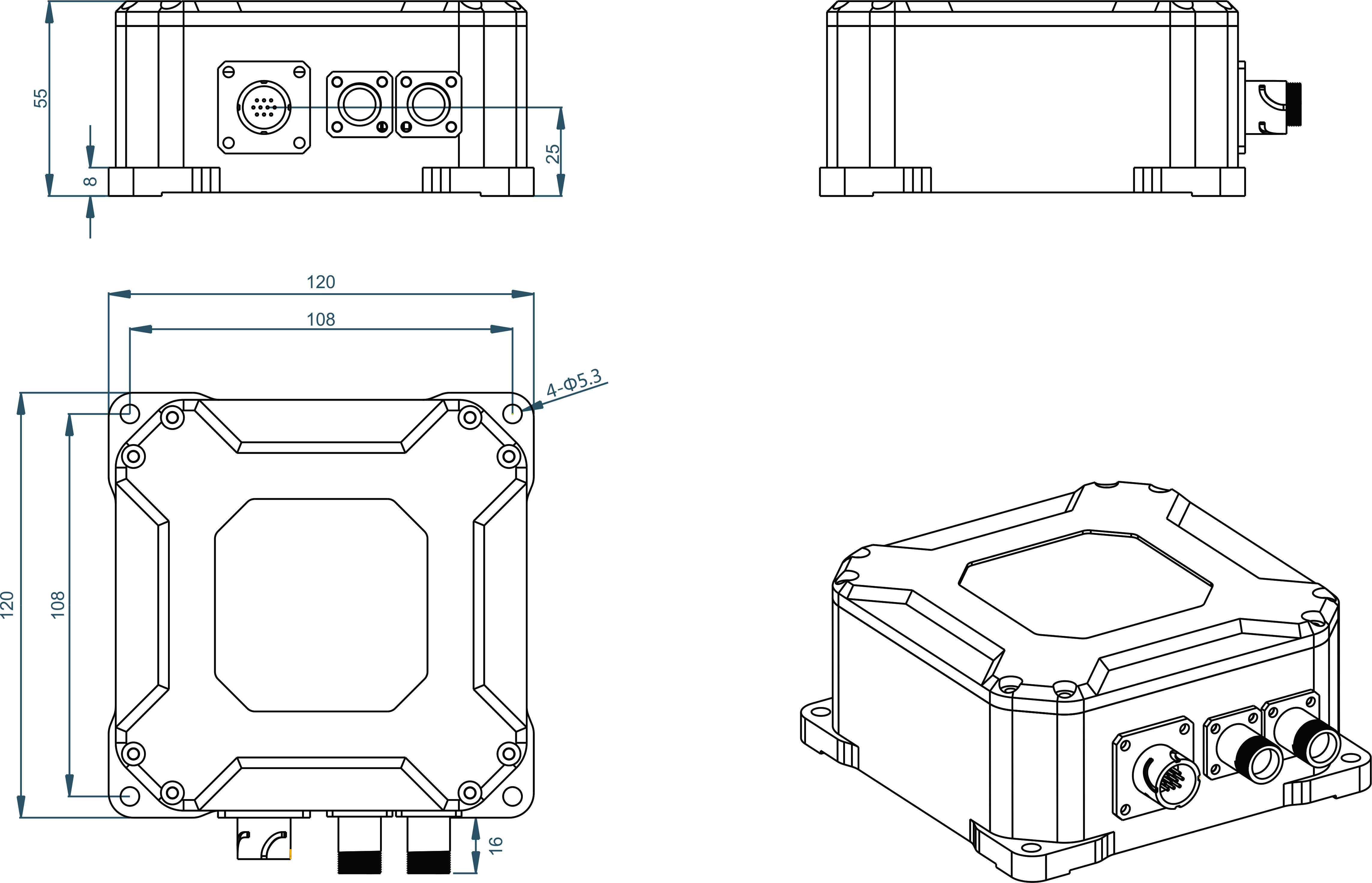
L120×W120×H55mm
L108×W108×H8mm
4 M5 screws
* Please contact the online sales engineer to obtain the product specification of Rion, or email sales@rion-tech.net to obtain it.


Copyright © RION TECHNOLOGY